Explore Layers on Same Server
R2026bYou might find a layer you like in the WMS Database and want to find other layers on the same server. You can explore other layers by using a capabilities document.
Specify the URL of the NASA SVS Image Server. Use the wmsinfo function to return the contents of the capabilities document as a WMSCapabilities object. A capabilities document is an XML document containing metadata that describes the geographic content a server offers.
serverURL = "http://svs.gsfc.nasa.gov/cgi-bin/wms?";
capabilities = wmsinfo(serverURL);
Set the layer titles to a variable. View the first three titles.
layerTitles = {capabilities.Layer.LayerTitle}';
layerTitles(1:3)
ans = 3×1 cell array
"'African Fires During 2002 (1024x1024 Animation)'"
"'Background Image for African Fires During 2002 (WMS)'"
"'Aurora over the North Pole on April 17, 1999 (360x100 Animation)'"
Read the layer containing tropospheric ozone impacts. Display the map.
layerTitle = "Tropospheric Ozone Impacts Global Climate Warming";
layer = refine(capabilities.Layer,layerTitle);
[A,R] = wmsread(layer);

figure
worldmap(A,R)
geoshow(A,R)
title(layer.LayerTitle)
plabel off
mlabel off
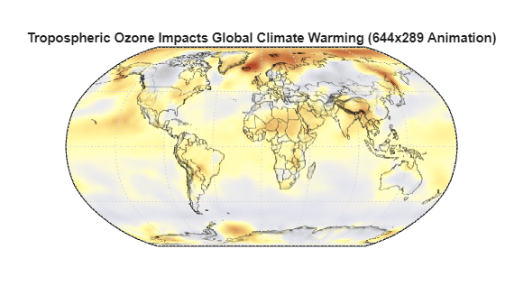
This layer contains data from different years. You can examine the available data by accessing the layer.Details.Dimension structure.
layer.Details.Dimension
ans = struct with fields:
              Name: 'time'
             Units: 'ISO8601'
        UnitSymbol: ''
           Default: '1994-'
    MultipleValues: 0
      NearestValue: 0
           Current: 0
            Extent: '1884-/1994-/P1Y'
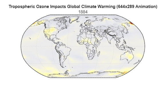
Display the map for the year 1884 and compare it with the map for 1994, the default year (displayed previously).
year = "1884";
[A2,R] = wmsread(layer,Time=year);
figure
worldmap(A2,R)
geoshow(A2,R)
title(layer.LayerTitle,year)
plabel off
mlabel off