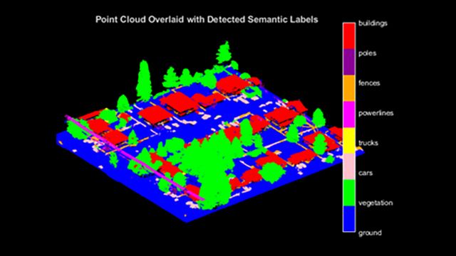
MATLAB supports multiple data formats and file types, including raster and vector files, image and video file formats, text and spreadsheets, and scientific data formats such as NetCDF, HDF5, GRIB, and USGS Landsat 8.
MATLAB Compatible Data Portals (partial list):
- ECMWF: Global historical climate data and forecasts can be acquired by Climate Data Store Toolbox for MATLAB
- NASA Earthdata: Collections of earth science data
- NOAA NCEI: Oceanic, atmospheric, and geophysical data from more than 130 observing platforms acquired by MATLAB Interface for NOAA Data
- ISC: Global parametric earthquake data can be acquired by ISC Earthquake Toolbox
- ENES: Global climate data and computational workspace that hosts MATLAB
Data Format and Web Service Support
MATLAB supports multiple common file formats and enables big data handling, Internet of Things (IoT) acquisition, and compute-intensive problem-solving with cluster computing and GPUs.
MATLAB Supported File Formats for Import and Export
Import data in MATLAB programmatically with supported file formats or use a specialized workflow. Acquire data directly from the web, hardware, and sensors, including your mobile phone and IoT.
Big Data
Access and integrate big data with your existing big data storage. Explore datastore and tall arrays to efficiently manage and analyze extensive datasets.
Parallel Computing Toolbox
Solve data- and compute-intensive problems using multicore processors, GPUs, and computer clusters through Parallel Computing Toolbox.


